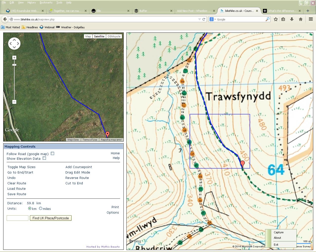
← Planning a new commute.
Use OS and Satellite images together to identify tracks on the ground.
Your email address will not be published. Required fields are marked *
Comment
Name *
Email *
Website
+ = ten